| Added | Tue, 19/09/2017 |
| Источники | |
| Дата публикации | Mon, 18/09/2017
|
| Версии |
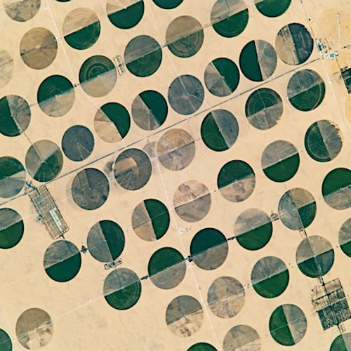
The astronaut on Board the International space station in October 2016 captured in the South-West of Egypt a lot of green circles in the sand. This territory is a remote agricultural complex, which is located in the Sahara desert at 290 km from the nearest town and 210 km from the Toshka lakes.
The Nubian aquifer system is buried under the sand, allows human settlements to survive in the desert. The aquifer is the sole source of water for Egyptians living away from the Nile river. More than 95% of Egypt is uninhabited desert, where average annual rainfall is 0 mm.
Crop circles are the result of pivot irrigation is an effective method of water conservation in agriculture. The groundwater of the Nubian aquifer out of the wells in the center of the circles and fly spray or flow from the long tubes that rotate around the center.
Dark green circles in the image, it's probably the potatoes; light brown — wheat. Most of the remaining crop represented by medicinal and aromatic plants such as chamomile. Bright circles of color tanned skin will likely show areas where the fire has removed the excess plant matter and cleared the land for the next harvest. Homegrown culture is transported via the desert road to Abu Simbel, Dakhla oasis airport and Sharq al-Owainat.
Translated by «Yandex.Translator»
© NASA
Translated by «Yandex.Translator»
Новости со схожими версиями
Log in or register to post comments

