| Added | Tue, 02/05/2017 |
| Источники | |
| Дата публикации | Mon, 01/05/2017
|
| Версии |
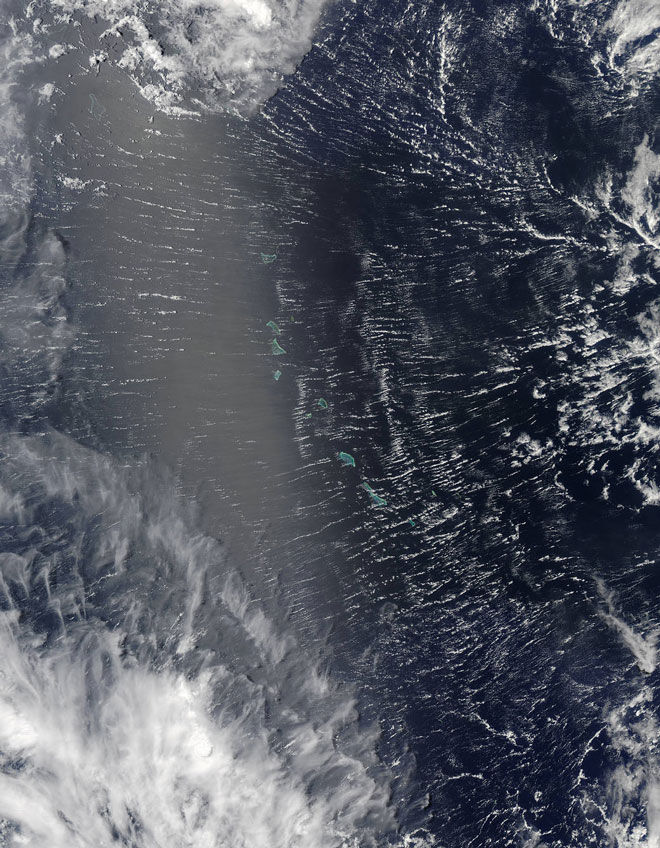
Clouds often visit the area above the equator of the Earth. On 7 April 2017, NASA satellite Terra has managed to capture views of the region from space. The lens of the MODIS got picturesque clouds over the Gilbert Islands in the Western Pacific ocean.
These clouds, however, were not typical for the tropics, says NASA. It was a gross parallel clouds caused by the formation of a tropical cyclone "cook" — just as the cyclone intensified around Vanuatu and headed towards New Caledonia.
"With the increasing cyclones are formed, how we think, the perfect conditions for the formation of these clouds," says Ralph foster, a scientist from the University of Washington.
Significant changes in speed and/or wind direction in a situation of formation of a cyclone generate additional turbulence already in the turbulent air layer near the Earth's surface. According to foster, in this situation of turbulent flow "organizes" and "rolls" long "coils" of moving in the opposite direction of the wind.
Help
Blurred and slightly faded vertical stripe along the entire length of the frame is sunlight reflected from the water surface at the same angle under which the satellite sees the investigated area.
Translated by «Yandex.Translator»
© NASA
Translated by «Yandex.Translator»
Новости со схожими версиями
Log in or register to post comments
