| ID | #1503569380 |
| Added | Thu, 24/08/2017 |
| Author | July N. |
| Sources | |
| Phenomena | |
| Status | Result
|
| Resume |
Initial data
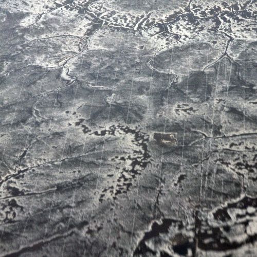
Huge "star map" found in the Krasnoyarsk region the researcher Tagil, Valentin Degtyarev.
In the study of satellite images , the researcher suddenly noticed an unusual and symmetrical drawings. They have the appearance of stars connected by lines. Their duration is not less than 1.5 km away.
To see these mysterious pictures is possible only from the air. Victor is convinced that the symbols are not random natural formations, and this is the message to earthlings from extraterrestrial civilizations.
Translated by «Yandex.Translator»
Hypotheses
Seismic profile

Geological dictionary defines the seismic profile as a straight line, rarely broken line on the Earth's surface along which the seismic receivers are arranged for the study of elastic (seismic) waves.
Distinguish between longitudinal profiles where the seismic receivers and the shot points are located on one straight line, and not longitudinal, where the seismic sensors are in a line not passing through the point of explosion.
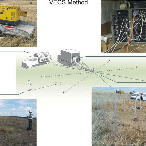
On the arc profile, the shotpoint is located in the center of the circle, arc with seismic sensors.
Investigation
Long sleeve regular longitudinal Linev these areas are seismic lines. This is probably some kind of similar structure.
An article in the newspaper Komsomolskaya Pravda-Krasnoyarsk, where the journalist interviewed Vyacheslav Indiscreet (chair of the Department of Technology and engineering exploration of mineral deposits at the Siberian Federal University and Vladimir Makarov, Director of Institute of oil and gas) on this subject, confirmed this hypothesis.
Vyacheslav Immodest analyzed image called star-shaped structure result from three-dimensional seismic exploration. Vladimir Makarov confirmed that the profiles of different orientirovochno on geometric shapes: intersecting lines, rays or "star" similar to izobrajenii in the pictures.
Translated by «Yandex.Translator»
Resume
Seismic profile

Geological dictionary defines the seismic profile as a straight line, rarely broken line on the Earth's surface along which the seismic receivers are arranged for the study of elastic (seismic) waves.
Distinguish between longitudinal profiles where the seismic receivers and the shot points are located on one straight line, and not longitudinal, where the seismic sensors are in a line not passing through the point of explosion.
On the arc profile, the shotpoint is located in the center of the circle, arc with seismic sensors.
Log in or register to post comments

