| Added | Thu, 17/08/2017 |
| Источники | |
| Дата публикации | Wed, 16/08/2017
|
| Версии |
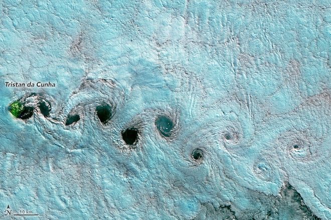
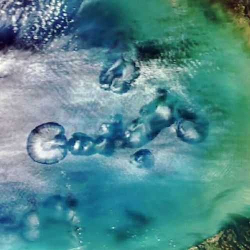
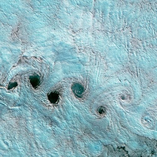
In 1912, physicist Theodore von Pocket first described the process of formation of long chains of cloud vortices in the sky, dubbed "track on the background of the Pocket." They occur when winds flow around blunt protruding region, often an island rising in the ocean. Alternating the direction of rotation in the air, it forms swirls in the clouds.
Satellites regularly detect these wind and cloud patterns around the world. May 24 scanning radiometer VIRS on the Suomi NPP satellite got a picture of these vortices on the leeward side of the volcanic island of Guadalupe, rising from the Pacific ocean off the coast of Baja California, Mexico.
According to Carlos Torres from the Autonomous University of Baja California, the vortex pattern depends on the intensity of the wind. The vortices are driven by the prevailing winds, which may seasonally vary and cause differences in their direction and structure.
The second picture shows the same phenomenon downwind of Tristan da Cunha — a remote volcanic archipelago in the South Atlantic. The picture was taken on June 25 operational cartographer OLI on the Landsat 8. Unlike the first image, here used about spectrum to better distinguish the area of land, water and clouds.
Translated by «Yandex.Translator»
© NASA
Translated by «Yandex.Translator»
Связанные факты
Новости со схожими версиями
Log in or register to post comments
