| Added | Thu, 18/10/2018 |
| Sources | |
| Феномены | |
| Version type |
The anomalous nature of the change of any parameter in the atmosphere with increasing altitude in meteorology azyvaetsja inversion (often mean temperature inversion, i.e. temperature increases with height in a layer of the atmosphere instead of the usual decrease).
There are two types of inversion:
- surface temperature inversions (thickness of the inversion layer tens of meters)
- temperature inversions in the free atmosphere (the thickness of the inversion layer reaches hundreds of meters)
Under certain conditions, the normal vertical temperature gradient is changed so that cooler air is near the Earth's surface. This can occur, for example, when the movement of warm, less dense air mass over cold, more dense layer. It occurs near warm fronts, and also in areas of oceanic upwelling (e.g. off the coast of California). With adequate moisture over a cold layer, typically, the formation of fog beneath the inversion "lid".
Clear, quiet night in the high cold air down the slopes and gather in the valleys, where the air temperature is lower than 100 or 200 m above. Over the cold layer is warmer air, which probably forms a cloud or haze.
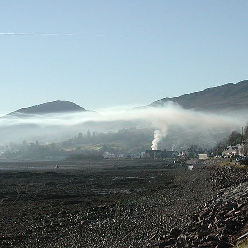
The temperature inversion prevents vertical movement of air and contributes to the formation of haze, fog, smog, clouds, mirages. Temperature inversion is clearly demonstrated by the example of smoke from a fire: smoke will rise vertically and then when it reaches the "layer inversion", will bend horizontally.
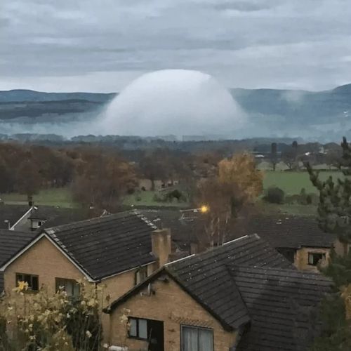
Interestingly, some UFO sightings seen on the radar screen or visually can be explained by the inversion of the air flow or its consequences (mirages, the formation of clouds, haze reflection at different light fluxes).
Translated by «Yandex.Translator»
The rising smoke is constrained by the overlying layer of warmer air (Scotland)
Translated by «Yandex.Translator»
Related facts
Related news
Log in or register to post comments


